Geophyical Survey: Bamburgh Castle Environs

In early 2023 the BRP was awarded funding from the Castle Studies Trust to undertake a series of non-invasive surveys to provide additional context to the outworks of Bamburgh Castle, focussing on St Oswald’s Gate and the Tower of Elmund’s Well. You can find out more about this area in our earlier blog posts (here’s a good place to start: Director’s End of Season Excavation Round-up).

We are now finalising the associated reports and sharing these ahead of releasing our interim excavation report. The next report we are sharing details a geophysical survey that we undertook with Dr Kristian Strutt of the Archaeological Prospection Services Southampton University exploring the environs of Bamburgh Castle.
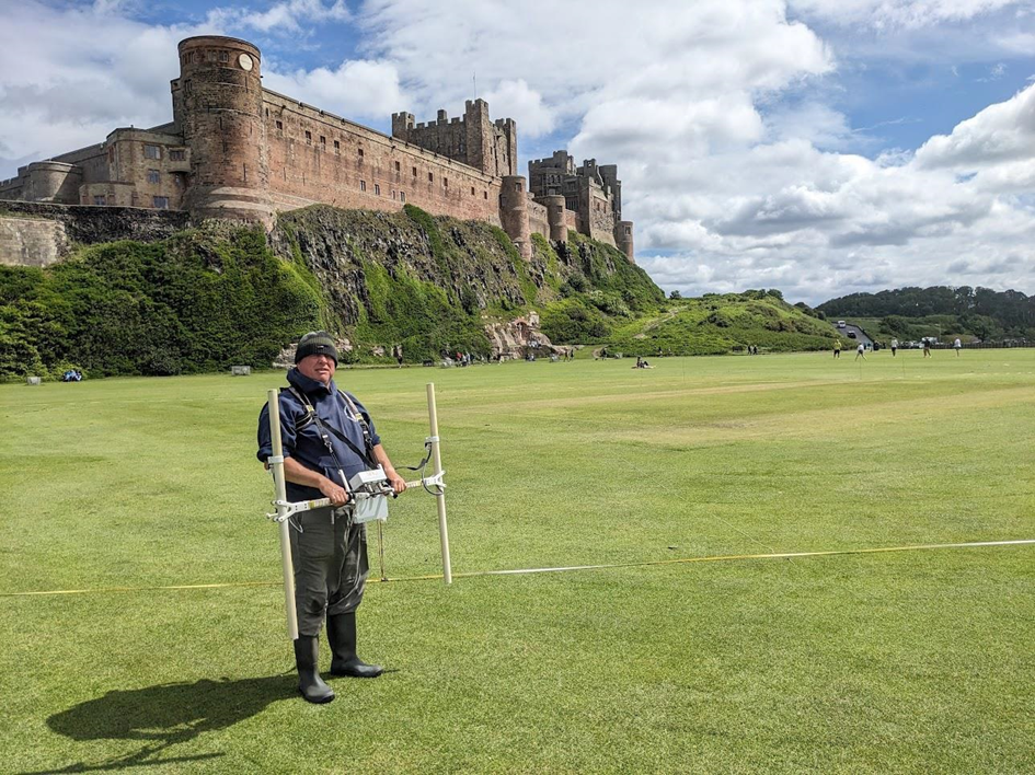
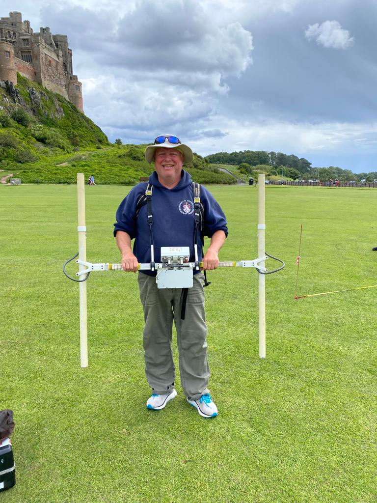
Person stood on large grassy area in front of large castle situated on rock promontory. Man is holding a white twin probe device with computer attached in middle

Dominic Barker using the Bartington Grad 601-2 instrument on the Cricket Ground (photo: K. Strutt)

The Geophysical Survey Results

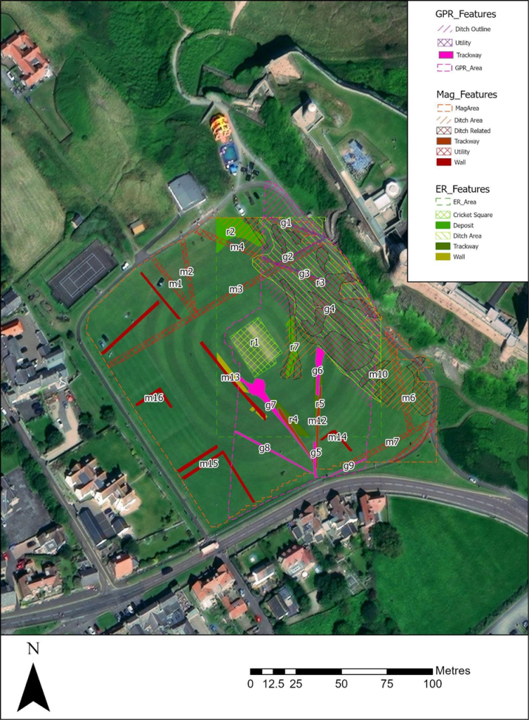
The survey utilised magnetometry, resistivity and Ground Penetrating Radar (GPR) survey of areas of the Cricket Ground to the west of Bamburgh Castle. The results indicate the possible presence of a large ditch, some 45m across, immediately to the west of the outcrop, in addition to trackways, walls and other features in the survey area.

One of the principal questions we were hoping to address with the geophysics was if the castle ditch extended across the sports field at the base of the castle rock. A ditch cut through sandstone, can been traced in the area of the modern entrance that is at the site of the 12th century gate. This feature extends across the front of the castle as far as the sandstone ridge was present above ground. The results of the GPR do seem to strongly indicate a large feature in the area where we would anticipate the castle ditch to be and the magnetometry and resistance surveys do seem to support this. It is intended to conduct further fieldwork, starting with coring, to confirm this.
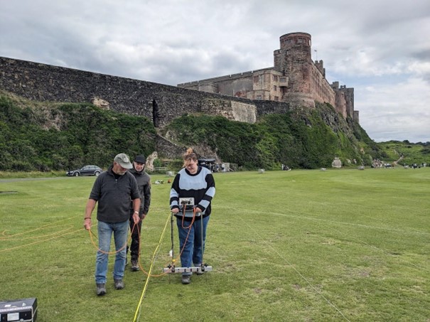
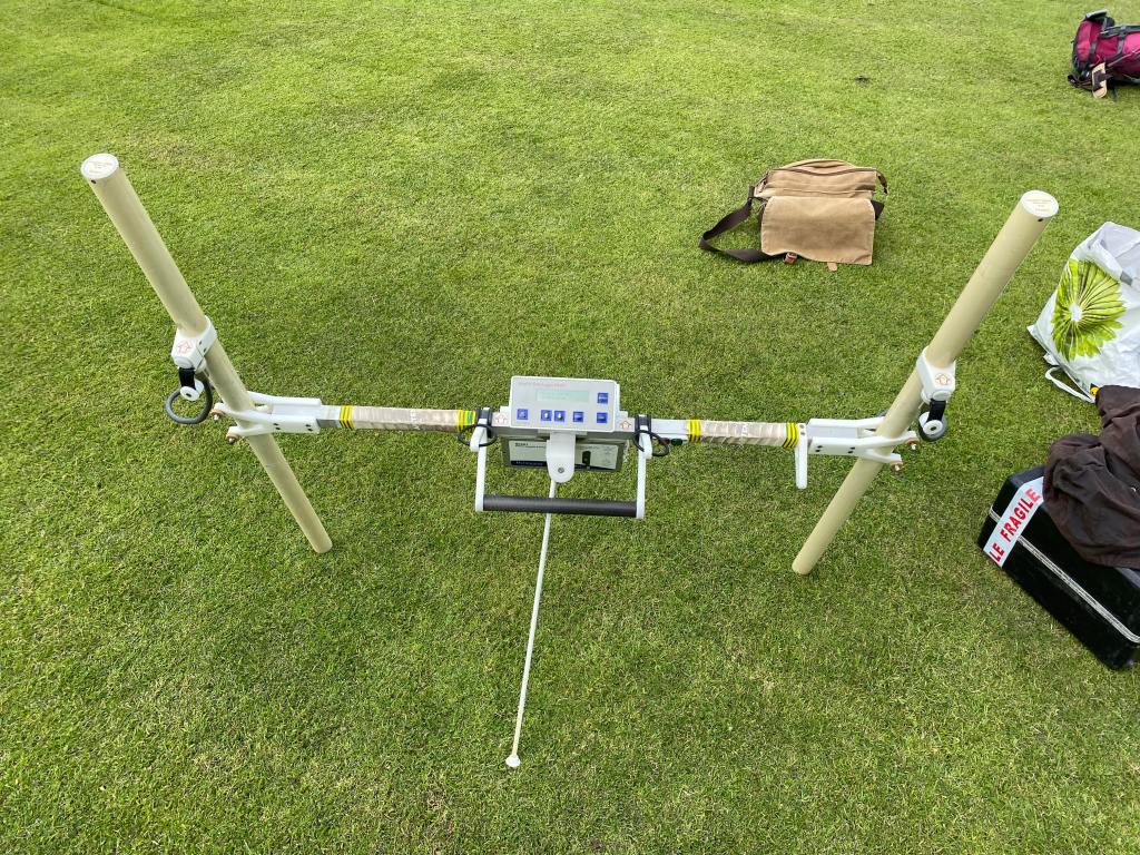
Three people stood on large grassy area in front of large castle situated on rock promontory. Person is holding a white twin probe device with computer attached in middle with wires hanging down

Earth resistance survey being carried out by BRP volunteers (photo: K. Strutt)

In addition, to the probable ditch feature, several features seen on the 1st Edition Ordnance Survey appear to be picked up on the surveys. Two trackways are evident, that lead to St Oswald’s Gate and to a cleft in the castle rock called the ‘Miller’s Nick’, which allowed people to scramble up to the West Ward in the 19th century. The second is an S-shaped path that meandered towards the area of St Oswald’s Gate, perhaps originally skirting around the edge of the ditch feature. One further route-way or path extends across the field parallel to the road in the village to the south, called the Wynding, that appears from records to have had a medieval origin. This path runs alongside a linear plot boundary and field boundaries and it will be interesting to see if more can be made from a number of anomalies that can be seen within the enclosure areas to the south and west of the plot.

The resistivity and ground penetrating radar surveys so far cover a more limited area, due to time constraints and public access. There is an area of low resistance that lies in just the area that the ditch would lie and matches up to the path towards the Miller’s Nick. The enclosure areas picked up in the magnetometry to the south-west also seems to be present on the resistivity. Notably, there is a high resistance feature that the S-shaped pathway may curve deliberately to avoid at the south part of the plot. A further T-shaped high resistance feature is present in the north-east extending from the area of the modern pavilion that will bear further study. The GPR further reinforces the presence of some of these features and indicates some depth to the anomaly that is interpreted as the ditch, though the signal attenuates before it could indicate a true depth.

Aerial image of the castle and surrounding landscape with overlays of each survey depicting where features have been found. Map key to the right.

Interpretation plot of all three surveys, labels link to the report text (Airbus 11/05/23)


Download the Full Report

If you want to take a deeper dive into the results of the geophysical survey you can download the report here: Report on the Geophysical Survey at Bamburgh, Northumberland, July 2023

It provides more information about the background to the site, detail about each survey technique and a breakdown, with useful maps and figures, about what was discovered.

In our forthcoming interim report we use this information to enhance our understanding of the castle within its landscape context and explore in more detail what some of the features identified in the survey might be.


The geophysical survey described in this blog has been funded by the Castle Studies Trust.

This charity is entirely reliant on donations from the public. To help the Trust to continue funding this kind of research, please visit https://www.castlestudiestrust.org/Donate

To find out more about the Trust please visit www.castlestudiestrust.org

Geophys: Days 2 and 3

We are almost finished with the electrical resistivity survey of the green around the cricket pitch, and we have also begun magnetometry! Talking through some of the preliminary results has revealed that even though this is a “hard science” collection of empirical data, it goes hand-in-hand with archival research, which we will talk about briefly at the end.

Smiling man in a blue hoodie holds an H-shaped white rig with the outer wall of a castle and some vegetation-covered mounds behind him in the middle distance and background.

The process for walking the grid system for magnetometry is much the same as the process we described earlier for resistivity with respect to our grid system, but we also have to account for the different spacing between the sensors. We are making each traverse (each straight line across the grid square) a half metre, and the instrument will take a measurement every 0.25m. We will receive four readings in each square and survey a swathe of 2m for every two passes. This survey can therefore be a bit quicker than the previous method we used.

The data is not fully processed yet, but we do have some intriguing bits that are showing up. Some of these are reasonably-confidently identified, but others are still a mystery. Running along the base of the rock, there seem to be utilities lines that the spotlights on the green are tapped into. (We have small, square gaps in our data because of the presence of those lights since they are caged.) There are also a number of utilities or services trenches by the edge of the pitch near the junction where you can turn to get onto the grass or continue up the paved ramp to the castle car park. The presence of the row of lights suggests that the cables from the northwest meet up with the hub in the southeast.

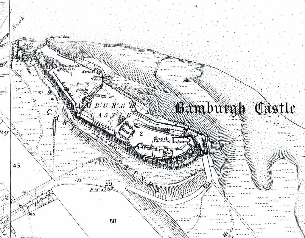
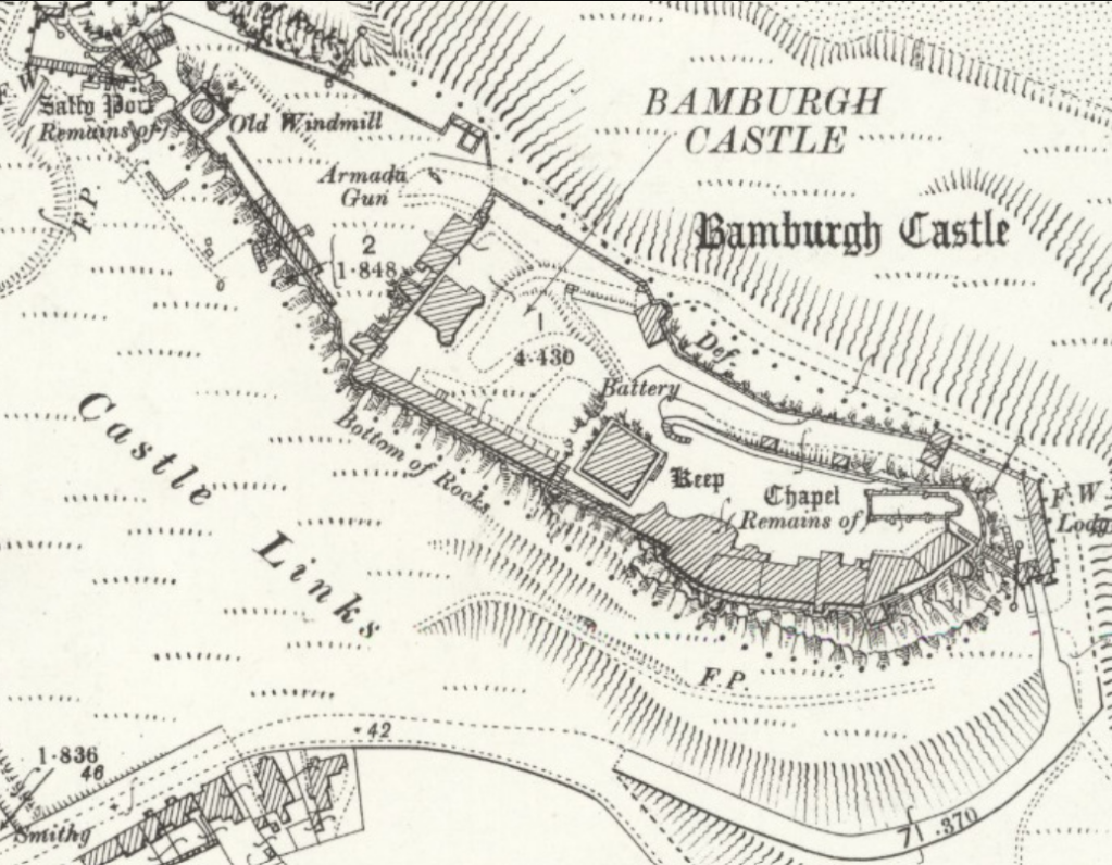
In addition to this modern material, we can see evidence of older roads or trackways. Just how old they are is still to be determined, but there are at least two in use in the 19th century, because our geophys team was able to cross-reference with their data with Ordnance Survey maps. The map below is from the 1860 survey’s first edition, and you can see the two paths across the green in the magnetometry data that is still being “cleaned up.” We will be publishing the full results in the fall hopefully, but for now, it’s probably better to show you the OS map so when the data is fully processed you can refer back to this post for the archival images that best exemplify the features we are picking out from the raw data. One path crosses the green where the cricket pitch now stands and might be heading towards the lowest part of the cleft that allowed access to the area of the well tower (which continues up the mount to Saint Oswald’s Gate). The trackway might be very old indeed, since the gate was the original entrance to the castle pre-Conquest. The other path heads directly for the Miller’s Nick. The Miller’s Nick is a narrow gap through the castle walls that gave the local community access to the West Ward’s windmill to grind their grain. Sometime after the sudden death of Dorothy Forster in 1715, her husband Lord Crewe devoted a portion of his resources to the local community at Bamburgh. If you’ve been to the West Ward, you would see a small staircase coming up right beside where Trench 3 was, crossing through the wall where Brian Hope-Taylor’s little offices are located.

Black and white ordnance survey map of Bamburgh Castle showing the major walls of the compound, slopes of green spaces, and contemporary footpaths. Additionally, plots on the edge of the village are numbered.
1860 Ordnance Survey Map, image from an old BRP blog post, but normally full file must be purchased from OS website.

There are some digitised images on Historic England’s archival site, and one also confirms that the Miller’s Nick path continues in use during the second half of the 19th century. Below is a view out from the castle towards the village, but there are still fields in use at this time; the crop field you can see is at the bend in the road and surrounded by a wall. In the OS map, the area labelled “45” is the field you’re seeing below. See the diagonal path at the very bottom of the photograph below? That seems to be the same path shown on the OS map.

Image from Historic England’s curated collection of early photographs, but their native embed code is not updated for this image. Access the record here.

The 1898 OS map held in the National Library of Scotland’s archives does not show the Miller’s Nick path anymore, nor the field plot that once filled the far side of the green. The abbreviation FP seems to be denoting extant footpaths. The advent of accurate cartography of Britain by the commissioning of the OS combined with the increased accessibility of photographic equipment is showing us the transformation of the green through visual media. The digitisation of these records makes historical landscape research much easier than the days of poring over giant maps in a reading room. Both approaches are however only successful due to the tireless work of archivists, for whom we are grateful.

Another black and white ordnance survey map of Bamburgh Castle showing the major structures of the compound, slopes of green spaces, and no visible footpaths. Additionally, plots on the edge of the village are numbered.
National Library of Scotland, “Northumberland (Old Series) XVII.1” published in 1898.

So we’ve got some identifications, but there’s still a few other features we haven’t nailed down yet. Extending out from the rock face are two wide bands that cross each other just to the south of the cricket wicket (which itself only appears on maps around the 1920s). They are linear features that are 3 or 4 metres wide extending from the base of the mount beneath the clock tower. We compared this to the same grid squares in the resistivity data and found that the wide features are not particularly deep down in the earth. Beside that wobbly X-shaped area, multiple linear features 30 metres long also start at the base of the mount, continuing onto the green. They terminate abruptly as if they were cut away during later landscaping. The green was sheep pasture at times, but we don’t know of any recent (last two centuries) programmes of works that may have gouged the earth near the base and could have destroyed those linear features.

Finally, we have rectilinear features on the edges of the green near the modern road where the field with the wall in the photograph stood. Structures in the same location are not recorded on the OS maps, so they are likely earlier than the 19th century. The next step might be to check paintings of the castle that feature that edge of the village. We also received some photos from locals that showed the outlines of structures in the grass of the green during exceptionally dry periods, as grass and crops can reveal underlying archaeology when the soil is parched.

One of the things that was pleasantly surprising about having the geophys team here was that we realised that this survey opportunity wasn’t just about numbers and maths and computer processing of huge datasets. The few head-scratching preliminary results of this survey also prompted us to go back into library archives and curated image collections for more media of the castle and the village. We revisited maps, photos, and art we had seen over the years, but also discovered newly-accessible images in major national repositories AND personal photographs from local residents. Archaeology is truly an interdisciplinary science that relies on the material culture, the clues in the ground, and the historical record when possible. We look forward to sharing our interpretations of this mag data with you all as soon as possible, so stay tuned!

This blog is brought to you as part of our 2023 grant-funded activities through the generosity of the Castle Studies Trust.

Geophys: Day 1

Our guest specialists from University of Southampton Kris Strutt and Dom Barker joined us on site yesterday to check some of their equipment before taking on small groups of students today. This morning, they taught the students how to properly set up a grid system for survey, and then spent the rest of the day having students take electrical resistivity measurements on the cricket pitch at the base of Bamburgh Castle.

Six people stand on green grass with a castle on a rocky outcrop in the background. The person in the centre of the image is holding a staff with a GPS system on it.

Setting Up the Grid

Before you can start surveying with geophysical techniques, you need an accurate grid system to ensure you are collecting data points that can be georeferenced to known locations, such as the Ordnance Survey maps produced for Britain. We used grid systems within our old trenches in the West Ward, which worked like a Cartesian plane (the x- and y-axis you used in maths in school). Every square metre of the trench could be associated with an Easting (x-coordinate, how east or west something is) and a Northing (y-coordinate, how north or south something is). (Weirdly, in American archaeology, you order them the other way around: Northing, then Easting.) Sorry, that’s a lot of parentheses. Anyway, in the old days we could use these coordinates to locate objects found in the sieve, because you could check the coordinates for the metre square you were digging in along with the context to narrow down the location; normally, small finds in the trench are replaced by a tag that we can measure with our EDM or dumpy level for elevation. Now we are applying a similar grid system to the cricket pitch!

Four people gather standing on the grass around a man with a GPS staff to look at the screen.

We were able to use a portable GPS staff to place a peg and bamboo stake (nearly) every 30 metres running from North-South across our survey area. We were basically on a diagonal from the outworks to the village, starting at 180 East/120 North. We moved south 30 metres, siting our next grid peg at 180 East/90 North. See how the Northing went down by 30? We moved south again, bringing us to 180 East, 60 North for the next peg. Once we put in as many grid pegs as we could, we moved east 30 metres and put in another North-South line of pegs that were parallel to our first line. This could be done with a compass with a sight along it, but the GPS staff allowed us to quickly find each coordinate. The screen would tell you what your coordinates were very precisely, so precisely that not holding the staff perfectly upright (with a little leveling bubble like the dumpy level stadia rod and EDM prism staff) could skew you by several centimetres at least. Being off by a few centimetres is not the end of the world, but ideally you want to only be off by 5cm at the maximum, and 1cm or less was preferable. We couldn’t get right up to the base of the mount in some areas due to vegetation, so we put in points 15m which were halfway between the 30m intervals so that we could still record points with our tech after. Normally we would be taking data points in each 30m by 30m square, but sometimes we couldn’t make a full square and had to use a partial square. When we began the resistivity survey, we made sure the students got practice on the full squares before setting them loose on the partial squares. All of this data could be downloaded at the end of the day via USB, and then we can import it into GIS (geographic information systems) software.

A closeup of the GPS system computer screen with a keypad below it. You can see the reflection of the transmitter in the screen.

The GPS system also had a voice that confirms your choices when you press buttons on the keypad, but it’s a generic American woman’s voice. Our team had a grand time suggesting sillier and sillier voices to include in the software so it would work like your automobile GPS and have different voices to set. The top four silly voices for the fancy GPS staff were: Brian Blessed (“To the LeeeeeeeEEEEeeEEEEEEeeeFT” but like this), Homer Simpson, Joanna Lumley as Patsy from “Absolutely Fabulous,” and Samuel L. Jackson (providing a stream of expletives, not linking that here).

A man in a navy blue sweater and grey bucket hat unwinds a roll of white washing line. Behind him a man in a blue hoodie with a grey baseball cap untangles another white washing line.

Once we got that large scale grid system in place, we laid out two surveyor tapes North-South at two adjacent lines of grid pegs. We had long stretches of washing line (without a metal core so it wouldn’t skew the signal) that had metre intervals marked, as well as a marker at 15m. We placed these East-West from one surveyor’s tape to the other so that they were perpendicular to our parallel pair.

Finally, we were ready to break out the electrical resistivity equipment.

Resistivity Process

You can learn more about the technology here, but we wanted to add some specifics from our survey. This methodology is all about closing a circuit, allowing electrical current to flow through the earth. We are measuring potential of a circuit (work done to move the current, voltage) and the resistance of the circuit (how easy it is to move the current). We were using a twin probe array, so we had a mobile pair and a remote pair connected to the ground a bit away from our grid square but all connected with cable. We are expecting high resistance, so our survey is done at a resolution (think of camera pixels) of 1 Ohm. Our survey is done at a resolution (think of camera pixels) of 1 Ohm which is the unit of resistance. 1 Ohm is 1 Volt (unit of electrical potential) per 1 Ampere (unit of electrical current).

A rectangle of metal pipe lies flat on the grass. The lower edge is a thicker bar with wires along it and two spiked metal probes protruding from the bottom. Two bamboo stakes lie at the bottom of the image.

You place the probe in the centre of the metre by metre square you’ve created with your various surveyor’s tapes and lines and wait for the machine to beep. The beep tells you a measurement has been taken; at the end of the line, it makes a longer beep to confirm you have 30 squares-worth. If you hear that long beep too soon, you’ve taken too many points thus far, and if you don’t hear it, you’ve not gone far enough, so either way you know if you goofed!

It doesn’t really matter which way you are facing when you begin your walk, but our experts suggested we all face north and head left to right (east to west) for the first pass. Then we would turn around at the end of the 30m and move south to the next row, heading back right to left (west to east). This made things easier to see in our mind, and it gave us a way to keep track of our path so we don’t goof up! If all your odd-numbered lines are going right, then all your even-numbered lines would be going left. This won’t mess up your data, as the equipment just records a string of numbers. Unfortunately, this means your grid really has to be accurate; if you make an error taking a measurement, you need to erase a whole line or the entire dataset instead of being able to remove a single incorrect reading after the survey is complete. Having multiple methods to keep you on track and test whether your process is correct is actually very helpful! Wouldn’t you rather know that you goofed at the end of a 30m walk than after you’ve surveyed a whole field?

A bearded man in a grey sweater, grey hat, and blue jeans swings the rig to the right as he walks along a surveyor's tape.

We had a blast out on the cricket pitch today, and look forward to sharing some data with you once it’s all processed and interpreted at the end of the summer. Stay tuned because we have also just received permission to survey some of the fields adjacent to the early medieval harbour!

This blog was brought to you as part of our 2023 grant-funded activities through the generosity of the Castle Studies Trust.

Funding Success for the Bamburgh Research Project with the Castle Studies Trust

The Bamburgh Research Project (BRP) are pleased to announce that we have been successful in securing £9306 from the Castle Studies Trust (CST).
Over the next 12 months the BRP will be utilising the funding to further explore Bamburgh Castle’s medieval outworks, particularly the area outside St Oswald’s Gate where our current excavation is underway as part of our annual field school. Our project is titled ‘Contextualising Bamburgh Castle: wells, towers, mounds and more!’

St Oswald’s Gate and the Medieval Outworks

St Oswald’s Gate and the outworks beyond lie in the area of the original entrance to the castle. It is very likely that the siege castle (named Mal Voisin in the Anglo-Saxon Chronicle) was built close to this gate in AD 1095. When the main access was re-sited, the entrance here remained as an important postern. Perhaps serving a small adjacent harbour immediately to the north of the site. This area now forms the BRP’s main investigative focus. The outworks consist of strong walls enclosing a trapezoidal area with the Tower of Elmund’s Well. With a more recent wall and postern to the west.

The outworks at St Oswald’s Gate are a rare case at Bamburgh as they have not been subject to extensive rebuilding in the post medieval period. Other than the reconstruction of the tower as a cottage, the outworks represent an astonishing window into mostly unaltered medieval fabric still standing at Bamburgh.

Foreground shows the area currently under excavation by the BRP with St Oswald’s Gate visible at the top of the steps and West Ward of Bamburgh Castle present in the background.

Work to Date

Recent investigation by the BRP has revealed that a substantial structure still survives below ground. This is in the form of an L-shaped corridor and steps down into the room that is thought to be the tower basement that contained the well. The presence of two splayed narrow windows appears to further indicate that this is part of the medieval Elmund’s Tower. The 2023 excavation season aims to reveal the full extent of the tower and identify any remains of the well depicted on the 19th century survey. You can find out more about our ongoing excavations in this area by taking a look at earlier blog posts: Investigations beyond St Oswald’s Gate: End of Season Overview.

What will the CST Funding be used for?

There are two primary aims for the CST funding. The first is to contextualise our recent excavations at Elmund’s Tower through geophysical survey (GPR and Magnetometry) and undertake a preliminary masonry survey of the castle’s associated extant outworks.

The geophysical survey will provide context to the area immediately outside of the outworks and identify if the castle ditch (seen as a rock cut feature at the Great Gate) extends all the way along the front of the castle. As part of the masonry survey the project will be using photogrammetry to create a 3D model of the standing outworks and internal structures of Elmund’s Tower. The survey will be undertaken in conjunction with a metric survey of the structures outlines so that a photo-real, stone by stone, 3D photo model can be used as a management tool for future plans, including consolidation work.

The investigation of the area will be used to aid in making management decisions to ensure the preservation of the outworks. More broadly, the proposed investigations will assist the interpretation of the extensive, but more complex and disturbed stratigraphical sequences recovered elsewhere in the castle, principally the West Ward.

We will also be using the photogrammetry and geophysical surveys as an opportunity to upskill BRP staff and provide add-on benefits to students during our annual field school (July 2023).

The second focus for the funding will be on disseminating our discoveries to the wider public. Bamburgh Castle is in the process of re-focussing the story it tells the public, giving greater focus to its medieval and early medieval history through a new website, signage throughout the grounds and new displays within the castle itself. However, the medieval outworks are inaccessible to the public and there is currently no opportunity to highlight the ongoing research into this area of the castle and how the site was shaped by the surrounding topography. The funding will allow us to create and install signage for visitors with a QR code for the 3D model, granting online access to Elmund’s Tower and the wider outworks. This information will also be replicated and enhanced with the creation of a new webpage on the Bamburgh Castle website. Alongside these permanent additions we will continue to share our work through our blog and social media.

Listen to two of our Directors discuss the project with the CST

Project Directors, Jo Kirton and Graeme Young, recently spoke to the CST about the project, which you can listen to here:

Make sure you follow our blog and social media accounts to see how the project progresses over the summer. We cannot wait to share what we discover!

Two places are now available to book in Week Three

Booking has filled up very fast this year but two places have now become available! These are both for Week Three (16th July to 22nd July) and as this is the week we will also be doing geophgysics as well as completing the excavation, it should be a really good one to be on.

Booking information, the booking form and email to ask any questions is available through this link

We look forward to seeing you in July

We Are Legally Required Not to Make This Title a Pun About St. Oswald’s Arm

The Inner Ward of Bamburgh Castle holds many secrets, and one of the most interesting at hand (…sorry, couldn’t help it) is the church of Saint Peter/chapel of Saint Oswald. Across from the modern staterooms stands a small ruin. Don’t be fooled, however, because the ruins were modified during the Victorian Age! There seems to have been an intention to rebuild a chapel on the spot even in the 18th century, but it was never completed and dismantled early in the 19th century. It was extremely fashionable to have ruins on your property if you were wealthy, and if you didn’t have actual remnants of historical buildings, you could simply commission some. There was a certain romance in the decaying masonry of peoples long since gone. We call the false ruins found scattered on estates throughout the country “Victorian follies.” The folly that demarcates the holy space at the top of the Bamburgh rock does contain the tiniest bit of 12th-century Norman masonry in the far corner, but otherwise only preserves a rough guess at where the Anglo-Saxon period church would have stood. The Anglo-Saxon church is mentioned in a few key chronicles of the period, including Historia ecclesiastica gentis Anglorum (Ecclesiastical History of English People) written by the Venerable Bede. In Bede’s time, the church was dedicated to Saint Peter, but Norman records suggest the same site became the chapel of Saint Oswald.

Manuscript excerpt featuring Saint Oswald; man with brown hair, sceptre, and globe.

Excerpt from Spencer 1, folio 89 reverse. (New York Public Library.)

Oswald was son of a Bernician king who had been sent to exile after the death of his father; he was victorious over the numerous rival communities and kingdoms during his reign, and he was regarded as the overking of the English, called Bretwalda. The northern kingdoms of Bernicia and Deira were joined for perhaps their most successful stretch by Oswald. The royal city of this now-united-but-only-temporarily kingdom was Bamburgh, at the time called Bebbanburh. The origin of that name seems to stem from the name of the wife of Æthelfrith, descendant of King Ida who was the first recorded Anglian king of Bernicia (547AD). Oswald encouraged the Celtic Christianity brought by Aidan (from Iona but later founder of Lindisfarne), making the united Northumbria a Christian kingdom.

Bede’s Ecclesiastical History is also full of many juicy little morsels about Anglo-Saxon kings, and King Oswald is no exception. One anecdote of Oswald’s piety witnessed by Aidan, bishop-turned-saint, is recounted by Bede:

At dinner, the two men received word that outside a crowd of beggars had amassed hoping the king would spare some food. Oswald immediately sent his silver plate piled with food out to them and had the plate broken up and pieces given to each. Aidan was so pleased by such a gentle and generous king, he held the hand that had offered relief to the poor of his kingdom and blessed him that his arm and hand would never wither. When Oswald was defeated by Penda, last pagan king of the Mercians, his head and limbs were struck from his body. The arm and hand were eventually recovered and sent to Bamburgh, where they lay in a reliquary of silver.

img_20190701_123415

The apse encircling the 19th-century bell is the only extant Norman masonry.

In 1997, 2000, and finally in 2010, the BRP did some geophysical surveys of the area where the Victorian folly now stands; the first year involved survey of resistivity (which measures how an electrical current travels through the ground), the second was ground-penetrating radar, while the last involved both methods, this time with the help of Channel 4’s Time Team crew. The initial data were promising, suggesting a vaulted crypt might lay beneath the ruins. After subsequent excavation, numerous features on the church site were discovered and recorded, but none that matched the anomaly from the surveys. One theory is that the shape was actually a signature of the subsurface material that had been flipped when the data were compiled. The area did however suggest Romano-British occupation, medieval construction phases, and post-medieval disturbance during the Armstrong rebuild period. All in all, the trenches, although not containing a crypt with or without a 1,377-year-old hand, proved incredibly valuable in our understanding of some of the Inner Ward of the castle.

So was this where Saint Peter’s church actually stood? What happened to Oswald’s miraculously uncorrupted arm and hand? Well, we aren’t quite sure. As much as we love solving mysteries with archaeology, a mystery that continues to remain just out of reach tantalizingly urges us forward to reassess our approaches and previous interpretations.

Geophysical Survey at the Bradford Kaims Uncovers a Possible Prehistoric Settlement

On the 17th and 18th of June, Graeme Attwood*, from Magnitude Surveys came to the Bradford Kaims to conduct a geophysical survey of the landscape surrounding the site. The survey produced some intriguing results which provided exciting information for future excavations of the wider archaeological landscape.

IMG_1138

Graeme Atwood from Magnitude Surveys performing a geophyiscal survey at the Bradford Kaims using a fluxgate gradiometer.

The geophysical survey conducted at the Kaims used a hand-pulled fluxgate gradiometer, a type of magnetometer, which measures magnetism. Magnetic survey is used in archaeology as it can detect magnetic anomalies in the ground, which may indicate the presence of subsurface archaeological features. The magnetic geophysical survey investigated a total area of approximately 2.3 hectares in order to assess the below ground archaeological potential of the Bradford Kaims, conducted as part of our wider investigation of the landscape. Our investigations integrate excavation, field walking, survey and paleoenvironmental coring to evaluate the extent and nature of human exploitation of this wetland environment.

The magnetometer survey was conducted in five areas across the landscape of the Bradford Kaims, both in the wetland areas that are the focus of our current excavations and of the hills surrounding them. The survey produced a number of magnetic anomalies, suggesting that a wide variety of archaeological features are sitting below the surface.

FullSizeRender (3)

Map showing the five areas in which geophysical survey was conducted at the Bradford Kaims

The fifth area investigated in the survey covered our excavations on the South-Side of the wetland. The results indicated an archaeological feature which is thought to be another large burnt mound, one of the features found across this site. We are confident of this interpretation as a small portion of the mound has been excavated in previously seasons. Part of our remit is to test the accuracy and scope of the geophysics by excavating the anomalies. This is working extremely well, giving huge scope for future work.

FullSizeRender

Results from the fifth area of survey showing magnetic anomaly 5a which has been interpreted as a burnt mound

The most exciting results, however come from the investigations of the wider landscape. The third area of magnetometry survey on Hoppenwood Bank near our area of excavation revealed positive magnetic anomalies with a strong archaeological character. Two large circular features; one measuring 13m in diameter, the other 14.5m in diameter, were identified. These circular features are similar to the magnetic anomalies produced by round houses. This suggests we may have identified a prehistoric, possibly Iron-Age settlement, at the Kaims! Within the large outer ring of what we think may be round houses, a series of smaller sub-circular anomalies were also identified. These features are between 0.75m and 2m in diameter, possibly produced by pits and post-holes which may indicate an internal structure to the large circular features which strengthens are interpretation that these may be roundhouses. The evidence that we may have discovered a settlement becomes more convincing when we consider the series of positive anomalies that have been found across the south-eastern portion of the third area. These anomalies are thought to be produced by the presence of pits and similar cut features, suggesting human activity in this area, strengthening the argument for the presence of a settlement. Settlement activity of this type is very rare in Northumberland and very exciting.

Results from the third area of survey showing the circular magnetic anomalies; 3a and 3b that have been interpreted as possible Iron-Age round houses.

This enthralling discovery has put all of the Kaims team in high spirits and we are planning to excavate the area of the settlement, next season. The geophysical anomalies identified in this survey have opened up the possibility of an exciting future for excavation of the Bradford Kaims!

*Afterword from Paul Gething: Graeme Attwood was a regular at the BRP for almost a decade. He came as a young student, became a staff member and eventually went on to run T1 in the Castle. He left the BRP to do postgrad work in Geophysics. He has returned often to visit and occasionally to do small scale work in Bamburgh and at the Kaims. He recently started his own geophysics company in Bradford, which is thriving. He went far above and beyond what we reasonably expected of him on a furiously hot few days. I have always admired his work ethic, but he surprised me with just how much he can do. It was a great pleasure to welcome Graeme back to the BRP and fantastic to work with him again and I look forward to working with him again in the future. I also look forward to seeing his business go from strength to strength.

Kaims Video update – Burnt mounds?

This is the latest video in our Bradford Kaims Wetland community heritage dig series. Last time we gave you coring, this time it’s all about the features. What exactly are we digging up? The sites themselves are remarkably well preserved and subtly different, and our excavations are revealing that the promontory identified by Richard Tipping’s coring was extensively used, with multiple sites of burned stones, intermittent pits and exciting results from the geophysics.

Get your fists ready… “Team Kaims!”

Coring with Matt Ross in Trench 42

I know I mentioned at the end of yesterday’s post that today’s blog would focus on coring at the Kaims. It turns out that everyone else has things they wanted to post as well, so “Coring with Matt Ross” is going to be delayed a few days. We are, however, continuing with the Kaims theme. The first of today’s posts is written by Kaims Coordinator Neal Lythe and provides an update on this seasons progress. The second of today’s blogs (to be posted later this evening), is written by Laurel Nagengast, “a true Kaimanoid”, about her experience with the Bamburgh Research Project and Bradford Kaims Project.

On that note, if any of our past students and/or volunteers would like to contribute a blog about their experience with us (to be posted in the off-season) please feel free to leave a message on our blog, on the Bamburgh Research Project facebook page, or on my facebook page (Megan Taylor).

 Kaims Update Week 7

Gerry, Media Director, filming the excavation of Trench 42

What a season it’s been so far at the Kaims. We have done numerous test pits. We re-excavated trench 4, to help understand context relationships in trench 6. We’ve performed numerous coring transects. And we’ve opened a series of brand new trenches in the adjacent field, based on the findings from the archaeological magnetometry survey performed by our friends at G.S.B.Prospection.

Based on the data supplied by G.S.B., we opened Trench 42 and immediately came down onto archaeology less than 10cm below our feet. We have also attempted to pinpoint various other anomalies, by placing a number of test pits in the immediate vicinity. After several weeks of digging–and, lets face it, horrendous weather–we have uncovered some cracking archaeology and some very nice finds, which include what is believed to be a sherd of prehistoric pottery, a very nice flint arrowhead, numerous flint scrapers and quite a lot of flint debotage (see “A Day at the Kaims” post).

Initial view of the stone slab that suggested a possible cist or cairn

The excavation of Trench 42 is progressing well, as we continue to uncover more and more of the large stone feature very similar to the one found in trench 6.  The presence of the large stone slab in the middle of the stone feature suggested a possible cist or cairn. Further excavation over the last few weeks has led us to revise our initial theories, and we now fairly certain we are dealing with a burnt mound, though as of yet, we cannot say what it may have been used for.

Hilary in the early stages of excavating the burnt mound

Numerous burnt mounds have been excavated all over Britain as well Northumberland itself. An example of these type of mounds is Titlington Mount in north Northumberland (report published by Peter Topping, 1998).

There are several lines of thought as to what these mounds are used for:  a sauna, meat curing, iron or copper extraction and even beer making. Further excavation at the Kaims site will hopefully expand our knowledge of burnt mounds in general, and more specifically, give us insight into how our ancestors were utilizing the wetland area of the Kaims. Initial assessment of several of the environmental samples taken from Trench 42 revealed surprisingly little. Contrary to our hopes, flotation produced very few, if any burnt seeds/grains, and minimal amounts of charcoal. In fact, the predominant content of the flot residue was modern wirey stems (aka roots). Hopefully, some of the samples yet to be flotted, will produce better results.

The effects of the rain

Week 7 started with rain and the loss of several true Kaimanoids. However, with a break in the terrible weather and reluctant acceptance of our loss, we moved on with more archaeology. Trench 55 looks nice and juicy, with several features poking through. The current theory is that they could be structural, and which may or may not relate to the activity in trench 42. As we are rapidly running out of time, we are quickly trying to record everything as is and we will not be excavating any features that we have in either of the two trenches this season.

“Represent!” (T-shirts are for sale)

In what is my last week, I have to say that this has been my favourite season on the project so far. Yes, even for someone who is not a pre-historian. I would like to thank all of the people for their hard work at the Kaims this year, you have all been fantastic. It’s been a pleasure to help teach you and I hope you all have a great time. We have uncovered some fantastic and interesting archaeology and we have had great fun along the way. To the True Kaimanoids, I have one thing to say, and I am sure you all know what that is. … Get your fists ready… “Team Kaims!!!!!” — Neal Lythe

Kaims crew, assemble!

Today Kaims Supervisor Graham Dixon reports on the first couple of weeks down at the Bradford Kaims

The Kaims is wet, we all know this. Trench 6 is located next to and in a peat bog. Mix this with a months worth of fairly constant rainfall, and we have something like this.

Trench 6, cleaned up and ready for photography…wait what?

What better time than now to open a new trench in the middle of Embleton’s Bog?

A couple of weeks before the start of the season, the Kaims played host to ex project member Graeme Atwood and Jimmy Adcock of GSB Prospection Ltd. The team of geophysicians ran a magnetometry survey over a spit of raised land which kicks out into Embleton’s Bog, the intention being to find more possible areas of occupation which relate to our already ever expanding site. Magnetometry surveys measure and map out the patterns of relative magnetism in the soil, often affected in the past by burning and the movement of soil. The results were very positive.

The geophysics map of the Bradford Kaims new site, courtesy of GSB.

 The circular, red anomaly represents an area of burning, which we hoped would prove to be similar to that already unearthed in trench 6. With permission from the land owner of the next door field, and a rare sunny day overhead, the Kaims team started to de-turf.

At the suggestion of the geophysics team, a 2 metre by 20 metre trench was plotted out cutting right through the middle of this anomaly. Our intention was to uncover either end of the area of burning in order to understand its extent fully. Just below the topsoil in what is now Trench 42, approximately 15 cm down, we came onto the burnt layer, paydirt. Kaims aficionados may recognise how similar the dark, burnt layer of soil is to what we have found in the previous seasons overlying the paved hearth feature in Trench 6. Again this has turned out to be packed full of broken up burnt stone. And in the middle of this, right at the centre, lying on one of its narrow edges, appeared a large flat slab of stone.

The stone slab from Trench 42, just after deturfing.

While only a few inches of this is currently visible out of the bottom of the trench, the mere presence of an unnaturally placed upright stone is enough excite your average archaeologist. Just poking out of the soil, the stone also looks like it has been pierced, as there is a circular hole in one side. This is not shown on its opposite side, as we have not dug downwards like the antiquarians of old, but this will be resolved as soon as the time is right. Our first thoughts, a Bronze Age cist burial. These are formed by placing large slabs into a box shape. These are held together by the weight of the stones, along with smaller packing stones beneath the soil they are in. I hasten to add at this point that it is difficult to tell anything for certain, however a cist burial, cut into an area of burnt and cracked stone would be a great piece of archaeology for our students to witness, and learn from. While no secure dating evidence has come out of the new trench so far, cist burials are generally seen in the Bronze Age. This would make it far from contemporary with our middle to late Stone Age site in the field next door. Having said this, it would be great to find that the site has been used and re-used for multiple phases of occupation throughout the past.

More to follow, but till then, Kaims out.